
|
Last update at: Apr 18, 2024, 12:09 AM
Go to Top
Go to Top
Go to Top
Go to Top
Go to Top
Go to Top
Go to Top
Go to Top
Go to Top
Go to Top
Go to Top
Go to Top
Go to Top
Go to Top
Go to Top
|
Frequently Asked Questions Printer Friendly Version |
|
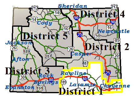
Closures & Advisories Search Conditions By Map Search By City Search By Route Search By District Variable Speed Limits Chain Law Neighboring States |
| District Comments | |
|---|---|
| District 1 (Southeast) | |
| Interstate 25 | |||||||
|---|---|---|---|---|---|---|---|
| Town | Location | Conditions | Advisories | Restrictions | Last Report Time | Cameras | Sensors |
|
Cheyenne
NWS Forecast |
Between the Colorado State Line and Cheyenne | Wet with Snowfall, Strong Winds | None | None | Apr 18, 2024, 12:09 AM |

|

|
| Between Cheyenne and Exit 29, Whitaker Rd | Wet with Snowfall | None | None | Apr 18, 2024, 12:09 AM |
|
|
|
| Interstate 80 | |||||||
|---|---|---|---|---|---|---|---|
| Town | Location | Conditions | Advisories | Restrictions | Last Report Time | Cameras | Sensors |
|
Rawlins
NWS Forecast |
Between Exit 187, Creston Jct and Rawlins | Dry | None | None | Apr 18, 2024, 12:09 AM |
|
|
| Between Rawlins and Exit 235, Walcott Jct | Wet | None | None | Apr 18, 2024, 12:09 AM |
|
|
|
|
Elk Mountain
NWS Forecast |
Between Exit 235, Walcott Jct and Exit 255, WY 72 | Wet with Snowfall | None | None | Apr 18, 2024, 12:09 AM |
|
|
| Between Exit 255, WY 72 and Exit 267, Wagonhound Rd | Wet with Snowfall | None | None | Apr 18, 2024, 12:09 AM |
|
|
|
|
Arlington
NWS Forecast |
Between Exit 267, Wagonhound Rd and Arlington | Slick in Spots with Snowfall | None | None | Apr 18, 2024, 12:09 AM |
|
|
| Between Arlington and Exit 279, Cooper Cove Rd | Slick in Spots with Snowfall | None | None | Apr 18, 2024, 12:09 AM |
|
|
|
|
Laramie
NWS Forecast |
Between Exit 279, Cooper Cove Rd and Exit 290, Quealy Dome | Wet with Snowfall | None | None | Apr 18, 2024, 12:09 AM |
|
|
| Between Exit 290, Quealy Dome and Laramie | Wet with Rain | None |
I 80 from milepost 300.440 to 302.910 Width restriction: 14 ft |
Apr 18, 2024, 12:09 AM |
|
|
|
| Between Laramie and Exit 323, Happy Jack Rd | Wet, Slick in Spots with Snowfall | None | None | Apr 18, 2024, 12:09 AM |
|
||
| Between Exit 323, Happy Jack Rd and Exit 335, Buford | Wet, Slick in Spots with Snowfall, Fog | Black Ice | None | Apr 18, 2024, 12:09 AM |
|
|
|
|
Cheyenne
NWS Forecast |
Between Exit 335, Buford and Exit 348, Otto Rd | Slick with Snowfall | None | None | Apr 18, 2024, 12:09 AM |
|
|
| EASTBOUND between Exit 348, Otto Rd and Exit 359, Junction I-25 | Slick in Spots | None | None | Apr 18, 2024, 12:14 AM |
|
|
|
| WESTBOUND between Exit 348, Otto Rd and Exit 359, Junction I-25 | Slick in Spots | None |
I 80 , US 30 from milepost 357.600 to 362.100 Width restriction: 14 ft |
Apr 18, 2024, 12:14 AM |
|
|
|
| EASTBOUND between Exit 359, Junction I-25 and Exit 364, College Drive | Wet with Snowfall | None | None | Apr 18, 2024, 12:09 AM | |||
| WESTBOUND between Exit 359, Junction I-25 and Exit 364, College Drive | Wet with Snowfall | None |
I 80 , US 30 from milepost 357.600 to 362.100 Width restriction: 14 ft |
Apr 18, 2024, 12:09 AM | |||
| Between Exit 364, College Drive and Exit 370, Archer Interchange | Wet with Snowfall | None | None | Apr 18, 2024, 12:09 AM | |||
| Between Exit 370, Archer Interchange and Exit 377, WY 217 | Wet with Snowfall | None | None | Apr 18, 2024, 12:09 AM |
|
|
|
|
Pine Bluffs
NWS Forecast |
Between Exit 377, WY 217 and Pine Bluffs | Dry | None | None | Apr 18, 2024, 12:09 AM |
|
|
| Between Pine Bluffs and the Nebraska State Line | Dry | None | None | Apr 18, 2024, 12:09 AM |
|
||
|
Arlington
NWS Forecast Arlington |
|||||||
|---|---|---|---|---|---|---|---|
| Route | Location | Conditions | Advisories | Restrictions | Last Report Time | Cameras | Sensors |
| I 80 | Between Exit 267, Wagonhound Rd and Arlington | Slick in Spots with Snowfall | None | None | Apr 18, 2024, 12:09 AM |
|
|
| Between Arlington and Exit 279, Cooper Cove Rd | Slick in Spots with Snowfall | None | None | Apr 18, 2024, 12:09 AM |
|
|
|
| WY 13 | Between Rock River and Arlington | Slick in Spots with Snowfall | None | None | Apr 18, 2024, 12:09 AM |
|
|
|
Baggs
NWS Forecast Baggs |
|||||||
|---|---|---|---|---|---|---|---|
| Route | Location | Conditions | Advisories | Restrictions | Last Report Time | Cameras | Sensors |
| WY 70 | Between WY 789 and Mile Marker 22 | Dry | None | None | Apr 18, 2024, 12:09 AM | ||
| Between Mile Marker 22 and Mile Marker 27, Eastbound Closure Gate | Dry | None | None | Apr 18, 2024, 12:09 AM | |||
| Between Mile Marker 27, Eastbound Closure Gate and Haskins Creek | Road Closed Due To Seasonal Closure | Apr 18, 2024, 12:09 AM | |||||
| WY 789 | Between Colorado State Line and Mile Marker 25 | Dry | None | None | Apr 18, 2024, 12:09 AM |
|
|
| Between Mile Marker 25 and I-80, Creston Junction | Dry | None | None | Apr 18, 2024, 12:09 AM |
|
||
|
Cheyenne
NWS Forecast Cheyenne |
|||||||
|---|---|---|---|---|---|---|---|
| Route | Location | Conditions | Advisories | Restrictions | Last Report Time | Cameras | Sensors |
| I 25 / US 87 | Between the Colorado State Line and Cheyenne | Wet with Snowfall, Strong Winds | None | None | Apr 18, 2024, 12:09 AM |
|
|
| Between Cheyenne and Exit 29, Whitaker Rd | Wet with Snowfall | None | None | Apr 18, 2024, 12:09 AM |
|
|
|
| Cheyenne Service Road | Between Archer Interchange and WY 217 | Wet with Snowfall | None | None | Apr 18, 2024, 12:09 AM | ||
| Between Exit 335, Buford and Exit 348, Otto Rd | Slick with Snowfall | None | None | Apr 18, 2024, 12:09 AM |
|
|
|
| between Exit 348, Otto Rd and Exit 359, Junction I-25 | Slick in Spots | None | None | Apr 18, 2024, 12:14 AM |
|
|
|
| between Exit 348, Otto Rd and Exit 359, Junction I-25 | Slick in Spots | None |
I 80 , US 30 from milepost 357.600 to 362.100 Width restriction: 14 ft |
Apr 18, 2024, 12:14 AM |
|
|
|
| between Exit 359, Junction I-25 and Exit 364, College Drive | Wet with Snowfall | None | None | Apr 18, 2024, 12:09 AM | |||
| between Exit 359, Junction I-25 and Exit 364, College Drive | Wet with Snowfall | None |
I 80 , US 30 from milepost 357.600 to 362.100 Width restriction: 14 ft |
Apr 18, 2024, 12:09 AM | |||
| Between Exit 364, College Drive and Exit 370, Archer Interchange | Wet with Snowfall | None | None | Apr 18, 2024, 12:09 AM | |||
| Between Exit 370, Archer Interchange and Exit 377, WY 217 | Wet with Snowfall | None | None | Apr 18, 2024, 12:09 AM |
|
|
|
| US 85 | Between the Colorado State Line and Cheyenne | Wet with Snowfall | None | None | Apr 18, 2024, 12:09 AM | ||
| Between Cheyenne and Meriden | Wet with Snowfall | None | None | Apr 18, 2024, 12:09 AM |
|
|
|
| WY 210 | Between Cheyenne and Mile Marker 16, County Rd 109, Table Mtn Rd | Wet with Snowfall | None | None | Apr 18, 2024, 12:09 AM | ||
| Between Mile Marker 16, County Rd 109, Table Mtn Rd and Curt Gowdy State Park | Wet with Snowfall, Fog | None | None | Apr 18, 2024, 12:09 AM |
|
|
|
| WY 211 | Between WY 219, Yellowstone Rd and Jordan Road | Wet with Snowfall | None |
WY 211 at milepost 20.460 Single unit 2-3 axles: 21T , Single unit 4-5 axles: 24T , Single unit 6+ axles: 27T , Truck & full trailer combos: 39T |
Apr 18, 2024, 12:09 AM |
|
|
| WY 212 | Between I-25, Cheyenne and East Four Mile Rd | Wet with Snowfall | None |
COLLEGE DR, I 25 BUS , WY 212 from milepost 0.150 to 2.710 Width restriction: 16 ft |
Apr 18, 2024, 12:09 AM |
|
|
| Between College Dr and WY 219, Yellowstone Rd | Wet with Snowfall | None | None | Apr 18, 2024, 12:09 AM | |||
| WY 222 | Between WY 225, Otto Rd and WY 211, Horse Creek Rd | Wet with Snowfall | None | None | Apr 18, 2024, 12:09 AM | ||
| WY 225 | Between I-80, Otto Rd and Cheyenne | Wet with Snowfall | None | None | Apr 18, 2024, 12:09 AM |
|
|
|
Elk Mountain
NWS Forecast Elk Mountain |
|||||||
|---|---|---|---|---|---|---|---|
| Route | Location | Conditions | Advisories | Restrictions | Last Report Time | Cameras | Sensors |
| I 80 | Between Exit 235, Walcott Jct and Exit 255, WY 72 | Wet with Snowfall | None | None | Apr 18, 2024, 12:09 AM |
|
|
| Between Exit 255, WY 72 and Exit 267, Wagonhound Rd | Wet with Snowfall | None | None | Apr 18, 2024, 12:09 AM |
|
|
|
| WY 72 | Between I-80 and Hanna Jct | Wet with Snowfall | None | None | Apr 18, 2024, 12:09 AM |
|
|
|
Laramie
NWS Forecast Laramie |
|||||||
|---|---|---|---|---|---|---|---|
| Route | Location | Conditions | Advisories | Restrictions | Last Report Time | Cameras | Sensors |
| I 80 | Between Exit 279, Cooper Cove Rd and Exit 290, Quealy Dome | Wet with Snowfall | None | None | Apr 18, 2024, 12:09 AM |
|
|
| Between Exit 290, Quealy Dome and Laramie | Wet with Rain | None |
I 80 from milepost 300.440 to 302.910 Width restriction: 14 ft |
Apr 18, 2024, 12:09 AM |
|
|
|
| Between Laramie and Exit 323, Happy Jack Rd | Wet, Slick in Spots with Snowfall | None | None | Apr 18, 2024, 12:09 AM |
|
||
| Between Exit 323, Happy Jack Rd and Exit 335, Buford | Wet, Slick in Spots with Snowfall, Fog | Black Ice | None | Apr 18, 2024, 12:09 AM |
|
|
|
| US 287 | Between the Colorado State Line and Start of Divided Highway, Mile Marker 416 | Wet with Rain | None | None | Apr 18, 2024, 12:09 AM |
|
|
| Between Start of Divided Highway, Mile Marker 416 and Mile Marker 413, 4 Miles North of Tie Siding | Wet with Rain | None | None | Apr 18, 2024, 12:09 AM | |||
| Between Mile Marker 413, 4 miles north of Tie Siding and Laramie | Wet with Rain | None | None | Apr 18, 2024, 12:09 AM |
|
||
| US 30/287 | Between Rock River and Divided Highway at Mile Marker 290 | Wet with Snowfall | None | None | Apr 18, 2024, 12:09 AM | ||
| Between Divided Highway at Mile Marker 290 and Divided Highway at Mile Marker 308 | Wet with Snowfall | None | None | Apr 18, 2024, 12:09 AM | |||
| Between Divided Highway at Mile Marker 308 and WY 34, Closure Gate | Wet with Snowfall | None | None | Apr 18, 2024, 12:09 AM | |||
| Between WY 34, Closure Gate and Laramie | Wet with Snowfall | None | None | Apr 18, 2024, 12:09 AM |
|
||
| WY 10 | Between Woods Landing and the Colorado State Line | Wet with Rain | None | None | Apr 18, 2024, 12:09 AM | ||
| WY 11 | Between WY 130 and Albany | Wet with Rain | None | None | Apr 18, 2024, 12:09 AM | ||
| WY 12 | Between WY 130 and Mandel Lane | Wet with Rain | None | None | Apr 18, 2024, 12:09 AM |
|
|
| WY 130 | Between Mirror Lake and Green Rock | Road Closed Due To Seasonal Closure | Apr 18, 2024, 12:09 AM | ||||
| Between Green Rock and Centennial | Slick in Spots with Snowfall | None |
WY 130 from milepost 34.500 to 68.020 Weight restriction: 80000 lbs |
Apr 18, 2024, 12:09 AM |
|
||
| Between Centennial and WY 130/230 | Wet with Rain | None | None | Apr 18, 2024, 12:09 AM | |||
| WY 210 | Between Curt Gowdy State Park and I-80 | Wet with Rain | None | None | Apr 18, 2024, 12:09 AM |
|
|
| WY 230 | Between the Colorado State Line and Woods Landing | Wet with Rain | None | None | Apr 18, 2024, 12:09 AM |
|
|
| Between Woods Landing and Laramie | Wet with Rain | None | None | Apr 18, 2024, 12:09 AM | |||
| WY 34 | Between Bosler and Morton Pass | Wet with Snowfall | None | None | Apr 18, 2024, 12:09 AM |
|
|
| Between Morton Pass and the Platte/Albany County Line | Wet with Snowfall | None | None | Apr 18, 2024, 12:09 AM | |||
|
Medicine Bow
NWS Forecast Medicine Bow |
|||||||
|---|---|---|---|---|---|---|---|
| Route | Location | Conditions | Advisories | Restrictions | Last Report Time | Cameras | Sensors |
| US 30/287 | Between I-80, Walcott Jct and Hanna Jct | Wet with Snowfall | None | None | Apr 18, 2024, 12:09 AM |
|
|
| Between Hanna Jct and Medicine Bow | Wet with Snowfall | None | None | Apr 18, 2024, 12:09 AM | |||
| Between Medicine Bow and Rock River | Wet with Snowfall | None | None | Apr 18, 2024, 12:09 AM |
|
||
| WY 487 | Between Medicine Bow and the South Jct WY 77 | Wet | None | None | Apr 18, 2024, 12:09 AM |
|
|
|
Pine Bluffs
NWS Forecast Pine Bluffs |
|||||||
|---|---|---|---|---|---|---|---|
| Route | Location | Conditions | Advisories | Restrictions | Last Report Time | Cameras | Sensors |
| I 80 / US 30 | Between Exit 377, WY 217 and Pine Bluffs | Dry | None | None | Apr 18, 2024, 12:09 AM |
|
|
| Between Pine Bluffs and the Nebraska State Line | Dry | None | None | Apr 18, 2024, 12:09 AM |
|
||
| WY 213 | Between I-80 and US 85 | Dry | None | None | Apr 18, 2024, 12:09 AM |
|
|
| WY 214 | Between I-80 and Carpenter | Dry | None | None | Apr 18, 2024, 12:09 AM |
|
|
| WY 215 | Between Pine Bluffs and Albin | Dry | None | None | Apr 18, 2024, 12:09 AM |
|
|
| WY 216 | Between US 85 and the Nebraska State Line | Dry | None | None | Apr 18, 2024, 12:09 AM |
|
|
|
Rawlins
NWS Forecast Rawlins |
|||||||
|---|---|---|---|---|---|---|---|
| Route | Location | Conditions | Advisories | Restrictions | Last Report Time | Cameras | Sensors |
| I 80 / US 30 / WY 789 | Between Exit 187, Creston Jct and Rawlins | Dry | None | None | Apr 18, 2024, 12:09 AM |
|
|
| Between Rawlins and Exit 235, Walcott Jct | Wet | None | None | Apr 18, 2024, 12:09 AM |
|
|
|
| US 287 / WY 789 | Between Rawlins and Mile Marker 23 | Dry | None | None | Apr 18, 2024, 12:09 AM |
|
|
| WY 71 | Between Rawlins and End of State Route | Dry | None | None | Apr 18, 2024, 12:09 AM | ||
|
Saratoga
NWS Forecast Saratoga |
|||||||
|---|---|---|---|---|---|---|---|
| Route | Location | Conditions | Advisories | Restrictions | Last Report Time | Cameras | Sensors |
| WY 130 | Between I-80, Walcott Jct and WY 230 | Dry | None | None | Apr 18, 2024, 12:09 AM |
|
|
| Between WY 230 and Mile Marker 48, Eastbound Closure Gate | Dry | None |
WY 130 from milepost 34.500 to 68.020 Weight restriction: 80000 lbs |
Apr 18, 2024, 12:09 AM | |||
| Between Mile Marker 48, Eastbound Closure Gate and Mirror Lake | Road Closed Due To Seasonal Closure | Apr 18, 2024, 12:09 AM | |||||
| WY 230 | Between WY 130 and Riverside | Dry | None | None | Apr 18, 2024, 12:09 AM | ||
| Between Riverside and the Colorado State Line | Wet | None | None | Apr 18, 2024, 12:09 AM |
|
|
|
| WY 70 | Between Haskins Creek and Mile Marker 50, Westbound Closure Gate | Road Closed Due To Seasonal Closure | Apr 18, 2024, 12:09 AM | ||||
| Between Mile Marker 50, Westbound Closure Gate and WY 230 | Dry | None | None | Apr 18, 2024, 12:09 AM | |||
|
NWS Forecast |
|||||||
|---|---|---|---|---|---|---|---|
| Route | Location | Conditions | Advisories | Restrictions | Last Report Time | Cameras | Sensors |
|
NWS Forecast |
|||||||
|---|---|---|---|---|---|---|---|
| Route | Location | Conditions | Advisories | Restrictions | Last Report Time | Cameras | Sensors |
|
NWS Forecast |
|||||||
|---|---|---|---|---|---|---|---|
| Route | Location | Conditions | Advisories | Restrictions | Last Report Time | Cameras | Sensors |
|
NWS Forecast |
|||||||
|---|---|---|---|---|---|---|---|
| Route | Location | Conditions | Advisories | Restrictions | Last Report Time | Cameras | Sensors |
|
NWS Forecast |
|||||||
|---|---|---|---|---|---|---|---|
| Route | Location | Conditions | Advisories | Restrictions | Last Report Time | Cameras | Sensors |
|
NWS Forecast |
|||||||
|---|---|---|---|---|---|---|---|
| Route | Location | Conditions | Advisories | Restrictions | Last Report Time | Cameras | Sensors |
| *Chain Law - Level 1 Definition |
| **Chain Law - Level 2 Definition |
| Other Definitions |
| Impact Levels | Description / Recommended Action |
|---|---|
| Low | Minimal impacts expected, use general caution. |
| Moderate | Some impacts expected, use extra caution. Stay alert for changing road and weather conditions. |
| High | Dangerous impacts expected, use extreme caution, delay travel or consider alternate route. If travel is necessary, slow down and allow extra time. |
| CLOSED | Per W.S. 24-1-109, motorists traveling on a closed road without permission from WYDOT or WHP may be subject to a fine of up to $750 and/or up to 30 days imprisonment. |
| Seasonal / Long-Duration Event | Impact level used to distinguish long-duration events from emergent events. |
|
|
|
| Citizen | Business | Government | Visitor | Contact Us | Copyright © 2024 State of Wyoming | Disclaimer | Privacy Policy | Media |
| Production Laramie v. 1.2.0.1740-20240329 | ||||||||