
|
|
Frequently Asked Questions Printer Friendly Version |
|
Closures & Advisories Search Conditions By Map Search By City Search By Route Search By District Variable Speed Limits Chain Law Neighboring States |

| District Comments | |
|---|---|
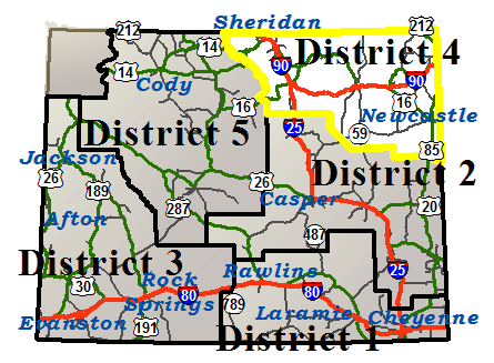
| District 4 (Northeast) | |
| Interstate 25 | |||||||
|---|---|---|---|---|---|---|---|
| Town | Location | Conditions | Advisories | Restrictions | Last Report Time | Cameras | Sensors |
|
Buffalo
NWS Forecast |
Between Exit 265, Reno Rd and Buffalo | Dry | None | None | Jul 2, 2026, 07:18 PM |

|

|
| Interstate 90 | |||||||
|---|---|---|---|---|---|---|---|
| Town | Location | Conditions | Advisories | Restrictions | Last Report Time | Cameras | Sensors |
|
Sheridan
NWS Forecast |
Between the Montana State Line and Ranchester | Dry | None | None | Jul 2, 2026, 07:18 PM |
|
|
| Between Ranchester and Sheridan | Dry | None | None | Jul 2, 2026, 07:18 PM |
|
||
| Between Sheridan and Exit 44, Piney Creek Rd | Dry | None | None | Jul 2, 2026, 07:18 PM |
|
|
|
|
Buffalo
NWS Forecast |
Between Exit 44, Piney Creek Rd and Buffalo | Dry | None | None | Jul 2, 2026, 07:18 PM |
|
|
| Between Buffalo and the Johnson/Campbell County Line | Dry | None | None | Jul 2, 2026, 07:18 PM |
|
|
|
|
Gillette
NWS Forecast |
Between the Johnson/Campbell County Line and Gillette | Dry | None | None | Jul 2, 2026, 07:18 PM |
|
|
| Between Gillette and Rozet | Dry | None | None | Jul 2, 2026, 07:18 PM |
|
||
|
Moorcroft
NWS Forecast |
Between Rozet and Moorcroft | Dry | None | None | Jul 2, 2026, 07:18 PM | ||
| Between Moorcroft and Exit 165, Pine Ridge Rd | Dry | None | None | Jul 2, 2026, 07:18 PM | |||
|
Sundance
NWS Forecast |
Between Exit 165, Pine Ridge Rd and Sundance | Dry | None | None | Jul 2, 2026, 07:18 PM |
|
|
| EASTBOUND between Sundance and the South Dakota State Line | Dry | None | None | Jul 2, 2026, 07:18 PM |
|
|
|
| WESTBOUND between Sundance and the South Dakota State Line | Dry | None |
I 90/US 14 from milepost 205.700 to 206.100 Height restriction: 15 ft 5 in |
Jul 2, 2026, 07:18 PM |
|
|
|
|
Buffalo
NWS Forecast Buffalo |
|||||||
|---|---|---|---|---|---|---|---|
| Route | Location | Conditions | Advisories | Restrictions | Last Report Time | Cameras | Sensors |
| I 25 / US 87 | Between Exit 265, Reno Rd and Buffalo | Dry | None | None | Jul 2, 2026, 07:18 PM |
|
|
| I 90 / US 87 | Between Exit 44, Piney Creek Rd and Buffalo | Dry | None | None | Jul 2, 2026, 07:18 PM |
|
|
| Between Buffalo and the Johnson/Campbell County Line | Dry | None | None | Jul 2, 2026, 07:18 PM |
|
|
|
| US 14/16 | Between Ucross and Mile Marker 60, the Sheridan/Campbell County Line | Dry | None | None | Jul 2, 2026, 07:18 PM |
|
|
| US 16 | Between Hunter Ranger Station and Buffalo | Dry | None | None | Jul 2, 2026, 07:18 PM |
|
|
| Between Buffalo and Ucross | Dry | None | None | Jul 2, 2026, 07:18 PM | |||
| WY 196 | Between Beaver Creek and Buffalo | Dry | None | None | Jul 2, 2026, 07:18 PM | ||
|
Burgess Junction
NWS Forecast Burgess Junction |
|||||||
|---|---|---|---|---|---|---|---|
| Route | Location | Conditions | Advisories | Restrictions | Last Report Time | Cameras | Sensors |
| US 14 | Between Antelope Butte Mountain Recreation Area and Elk View | Dry | None | None | Jul 2, 2026, 07:18 PM |
|
|
| Between Elk View and Steamboat Rock | Dry | None | None | Jul 2, 2026, 07:18 PM |
|
||
| Between Steamboat Rock and Dayton School | Dry | Falling Rock | None | Jul 2, 2026, 07:18 PM | |||
| US 14 A | Between the Sheridan/Big Horn County Line and Bear Lodge | Dry | None | None | Jul 2, 2026, 07:18 PM | ||
|
Gillette
NWS Forecast Gillette |
|||||||
|---|---|---|---|---|---|---|---|
| Route | Location | Conditions | Advisories | Restrictions | Last Report Time | Cameras | Sensors |
| I 90 | Between the Johnson/Campbell County Line and Gillette | Dry | None | None | Jul 2, 2026, 07:18 PM |
|
|
| Between Gillette and Rozet | Dry | None | None | Jul 2, 2026, 07:18 PM |
|
||
| US 14/16 | Between Mile Marker 60, the Sheridan/Campbell County Line and WY 59 | Dry | None | None | Jul 2, 2026, 07:18 PM | ||
| Between WY 59 and Gillette | Dry | None | None | Jul 2, 2026, 07:18 PM | |||
| WY 50 | Between Gillette and Mile Marker 12, Clarkelen Rd Closure Gate | Dry | None | None | Jul 2, 2026, 07:18 PM | ||
| Between Mile Marker 12, Clarkelen Rd Closure Gate and Pine Tree Junction | Dry | None | None | Jul 2, 2026, 07:18 PM |
|
|
|
| WY 51 | Between Gillette and Rozet | Dry | None | None | Jul 2, 2026, 07:18 PM | ||
| WY 59 | Between Mile Marker 94, Haight Rd and Gillette | Dry | None | None | Jul 2, 2026, 07:18 PM | ||
| Between US 14/16 and Mile Marker 126, Northbound Closure Gate | Dry | None | None | Jul 2, 2026, 07:18 PM | |||
| Between Mile Marker 126, Northbound Closure Gate and the Montana State Line | Dry | None | None | Jul 2, 2026, 07:18 PM | |||
|
Hulett
NWS Forecast Hulett |
|||||||
|---|---|---|---|---|---|---|---|
| Route | Location | Conditions | Advisories | Restrictions | Last Report Time | Cameras | Sensors |
| US 212 | Between the Montana State Line and the South Dakota State Line | Dry | None | None | Jul 2, 2026, 07:18 PM |
|
|
| WY 110 | Between WY 24 and Devils Tower Nat'l Monument | Dry | None |
WY 110 from milepost 0.000 to 0.020 Height restriction: 20 ft 6 in |
Jul 2, 2026, 07:18 PM |
|
|
| WY 112 | Between Hulett and Strawberry Hill | Dry | None | None | Jul 2, 2026, 07:18 PM | ||
| Between Strawberry Hill and the Montana State Line | Dry | None | None | Jul 2, 2026, 07:18 PM | |||
| WY 24 | Between US 14 and Hulett | Dry | None |
WY 24 from milepost 0.000 to 0.100 Height restriction: 19 ft WY 24 from milepost 5.970 to 5.990 Height restriction: 20 ft 6 in |
Jul 2, 2026, 07:18 PM |
|
|
| Between Hulett and the east side of Bear Lodge | Dry | None | None | Jul 2, 2026, 07:18 PM | |||
|
Moorcroft
NWS Forecast Moorcroft |
|||||||
|---|---|---|---|---|---|---|---|
| Route | Location | Conditions | Advisories | Restrictions | Last Report Time | Cameras | Sensors |
| I 90 / US 14/16 | Between Rozet and Moorcroft | Dry | None | None | Jul 2, 2026, 07:18 PM | ||
| Between Moorcroft and Exit 165, Pine Ridge Rd | Dry | None | None | Jul 2, 2026, 07:18 PM | |||
| US 14 | Between Moorcroft and WY 113 | Dry | None | None | Jul 2, 2026, 07:18 PM | ||
| Between WY 113 and Carlile | Dry | None | None | Jul 2, 2026, 07:18 PM | |||
| US 16 | Between Moorcroft and Weston/Crook County Line | Dry | None | None | Jul 2, 2026, 07:18 PM | ||
| Between Weston/Crook County Line and Upton | Dry | None | None | Jul 2, 2026, 07:18 PM | |||
| WY 113 | Between US 14 and Pine Haven | Dry | None | None | Jul 2, 2026, 07:18 PM | ||
| WY 51 | Between Rozet and Moorcroft | Dry | None |
WY 51 at milepost 143.600 Single unit 6+ axles: 33T |
Jul 2, 2026, 07:18 PM | ||
|
Newcastle
NWS Forecast Newcastle |
|||||||
|---|---|---|---|---|---|---|---|
| Route | Location | Conditions | Advisories | Restrictions | Last Report Time | Cameras | Sensors |
| US 16 | Between Upton and Newcastle | Dry | None | Single unit 6+ axles: 32T | Jul 2, 2026, 07:18 PM | ||
| Between Mile Marker 249 and Mile Marker 254, Eastbound Closure Gate | Dry | None | None | Jul 2, 2026, 07:18 PM | |||
| Between Mile Marker 254, Eastbound Closure Gate and the South Dakota State Line | Dry | None | None | Jul 2, 2026, 07:18 PM | |||
| US 16 Bypass | Between Mile Marker 247 and Mile Marker 249 | Dry | None | None | Jul 2, 2026, 07:18 PM | ||
| US 18 | Between Mule Creek Jct and the South Dakota State Line | Dry | None | None | Jul 2, 2026, 07:18 PM |
|
|
| US 85 | Between Mule Creek Jct and Niobrara/Weston County Line | Dry | None | None | Jul 2, 2026, 07:18 PM |
|
|
| Between Newcastle and WY 585, Four Corners | Dry with Strong Winds | None | None | Jul 2, 2026, 09:53 PM |
|
|
|
| Between Niobrara/Weston County Line and Newcastle | Dry | None | None | Jul 2, 2026, 07:18 PM | |||
| Between WY 585, Four Corners and the South Dakota State Line | Dry with Strong Winds | None | None | Jul 2, 2026, 09:53 PM |
|
|
|
| WY 116 | Between Upton and WY 450 | Dry | None | None | Jul 2, 2026, 07:18 PM | ||
| WY 450 | Between Newcastle and WY 116 | Dry | None | None | Jul 2, 2026, 07:18 PM | ||
| Between WY 116 and the Campbell/Weston County Line | Dry | None | None | Jul 2, 2026, 07:18 PM | |||
|
Powder River Pass
NWS Forecast Powder River Pass |
|||||||
|---|---|---|---|---|---|---|---|
| Route | Location | Conditions | Advisories | Restrictions | Last Report Time | Cameras | Sensors |
| US 16 | Between Deer Haven Lodge and Canyon Creek Rd | Dry | None | None | Jul 2, 2026, 07:18 PM |
|
|
| Between Canyon Creek Rd and Sheep Mountain Rd | Dry | None | None | Jul 2, 2026, 07:18 PM |
|
||
| Between Sheep Mountain Rd and Hunter Ranger Station | Dry | None | None | Jul 2, 2026, 07:18 PM | |||
|
Reno Junction
NWS Forecast Reno Junction |
|||||||
|---|---|---|---|---|---|---|---|
| Route | Location | Conditions | Advisories | Restrictions | Last Report Time | Cameras | Sensors |
| WY 387 | Between Pine Tree Jct and Wright | Dry | None | None | Jul 2, 2026, 07:18 PM |
|
|
| Between Wright and Reno Jct | Dry | None | None | Jul 2, 2026, 07:18 PM | |||
| WY 450 | Between the Campbell/Weston County Line and Mile Marker 54, Eastbound Closure Gate | Dry | None | None | Jul 2, 2026, 07:18 PM | ||
| Between Mile Marker 54, Eastbound Closure Gate and WY 59 | Dry | None | None | Jul 2, 2026, 07:18 PM | |||
| WY 59 | Between the Campbell/Converse Cty Line and Mile Marker 67, Edwards Rd | Dry | None | None | Jul 2, 2026, 07:18 PM | ||
| Between Mile Marker 67, Edwards Rd and Wright | Dry | None | None | Jul 2, 2026, 07:18 PM | |||
| Between Wright and Mile Marker 94, Haight Rd | Dry | None | None | Jul 2, 2026, 07:18 PM |
|
|
|
|
Sheridan
NWS Forecast Sheridan |
|||||||
|---|---|---|---|---|---|---|---|
| Route | Location | Conditions | Advisories | Restrictions | Last Report Time | Cameras | Sensors |
| I 90 / US 87 | Between the Montana State Line and Ranchester | Dry | None | None | Jul 2, 2026, 07:18 PM |
|
|
| Between Ranchester and Sheridan | Dry | None | None | Jul 2, 2026, 07:18 PM |
|
||
| Between Sheridan and Exit 44, Piney Creek Rd | Dry | None | None | Jul 2, 2026, 07:18 PM |
|
|
|
| US 14 | Between Dayton and Ranchester | Dry | None | None | Jul 2, 2026, 07:18 PM |
|
|
| Between Sheridan and Ucross | Dry | None | None | Jul 2, 2026, 07:18 PM |
|
|
|
| US 87 | Between Banner and Sheridan | Dry | None | None | Jul 2, 2026, 07:18 PM | ||
| WY 193 | Between Kearny and Banner | Dry | None | None | Jul 2, 2026, 07:18 PM |
|
|
| WY 194 | Between Story and End of State Route | Dry | None | None | Jul 2, 2026, 07:18 PM | ||
| WY 331 | Between Sheridan and Beckton | Dry | None | None | Jul 2, 2026, 07:18 PM | ||
| WY 332 | Between Sheridan and WY 334 | Dry | None | None | Jul 2, 2026, 07:18 PM | ||
| WY 335 | Between US 87 and Red Grade Rd | Dry | None | None | Jul 2, 2026, 07:18 PM | ||
| WY 336 | Between Sheridan and Dutch Creek Rd | Dry | None | None | Jul 2, 2026, 07:18 PM | ||
| WY 338 | Between Sheridan and the Montana State Line | Dry | None | None | Jul 2, 2026, 07:18 PM | ||
| WY 340 | Between Story and North Piney Creek | Dry | None | None | Jul 2, 2026, 07:18 PM | ||
| WY 343 | Between WY 345 and Dayton | Dry | None | None | Jul 2, 2026, 07:18 PM | ||
| WY 345 | Between the Montana State Line and Ranchester | Dry | None | None | Jul 2, 2026, 07:18 PM | ||
| Between Ranchester and I-90 | Dry | None | None | Jul 2, 2026, 07:18 PM | |||
|
Sundance
NWS Forecast Sundance |
|||||||
|---|---|---|---|---|---|---|---|
| Route | Location | Conditions | Advisories | Restrictions | Last Report Time | Cameras | Sensors |
| I 90 | Between Exit 165, Pine Ridge Rd and Sundance | Dry | None | None | Jul 2, 2026, 07:18 PM |
|
|
| between Sundance and the South Dakota State Line | Dry | None | None | Jul 2, 2026, 07:18 PM |
|
|
|
| between Sundance and the South Dakota State Line | Dry | None |
I 90/US 14 from milepost 205.700 to 206.100 Height restriction: 15 ft 5 in |
Jul 2, 2026, 07:18 PM |
|
|
|
| I 90 Business | Between Sundance and South Dakota State Line | Dry | None | None | Jul 2, 2026, 07:18 PM | ||
| US 14 | Between Carlile and WY 24 | Dry | None | None | Jul 2, 2026, 07:18 PM | ||
| Between WY 24 and Sundance | Dry | None |
US 14 from milepost 181.100 to 181.300 Height restriction: 19 ft |
Jul 2, 2026, 07:18 PM |
|
|
|
| WY 111 | Between Aladdin and I-90 | Dry | None |
WY 111 from milepost 0.000 to 0.050 Height restriction: 19 ft |
Jul 2, 2026, 07:18 PM | ||
| WY 116 | Between Sundance and Upton | Dry | None | None | Jul 2, 2026, 07:18 PM | ||
| WY 24 | Between the east side of Bear Lodge and the South Dakota State Line | Dry | None |
WY 24 from milepost 39.650 to 39.670 Height restriction: 19 ft |
Jul 2, 2026, 07:18 PM | ||
| WY 585 | Between Crook/Weston County Line and Sundance | Dry | None | None | Jul 2, 2026, 07:18 PM | ||
| Between Four Corners and Crook/Weston County Line | Dry with Strong Winds | None | None | Jul 2, 2026, 09:53 PM |
|
|
|
|
NWS Forecast |
|||||||
|---|---|---|---|---|---|---|---|
| Route | Location | Conditions | Advisories | Restrictions | Last Report Time | Cameras | Sensors |
|
NWS Forecast |
|||||||
|---|---|---|---|---|---|---|---|
| Route | Location | Conditions | Advisories | Restrictions | Last Report Time | Cameras | Sensors |
|
NWS Forecast |
|||||||
|---|---|---|---|---|---|---|---|
| Route | Location | Conditions | Advisories | Restrictions | Last Report Time | Cameras | Sensors |
|
NWS Forecast |
|||||||
|---|---|---|---|---|---|---|---|
| Route | Location | Conditions | Advisories | Restrictions | Last Report Time | Cameras | Sensors |
|
NWS Forecast |
|||||||
|---|---|---|---|---|---|---|---|
| Route | Location | Conditions | Advisories | Restrictions | Last Report Time | Cameras | Sensors |
| *Chain Law - Level 1 Definition |
| **Chain Law - Level 2 Definition |
| Other Definitions |
| Impact Levels | Description / Recommended Action |
|---|---|
| Low | Minimal impacts expected, use general caution. |
| Moderate | Some impacts expected, use extra caution. Stay alert for changing road and weather conditions. |
| High | Dangerous impacts expected, use extreme caution, delay travel or consider alternate route. If travel is necessary, slow down and allow extra time. |
| CLOSED | Per W.S. 24-1-109, motorists traveling on a closed road without permission from WYDOT or WHP may be subject to a fine of up to $750 and/or up to 30 days imprisonment. |
| Seasonal / Long-Duration Event | Impact level used to distinguish long-duration events from emergent events. |
|
|
|
| Citizen | Business | Government | Visitor | Contact Us | Copyright © 2026 State of Wyoming | Disclaimer | Privacy Policy | Media |
| Production Cheyenne v. 1.2.0.2264-20260420 | ||||||||